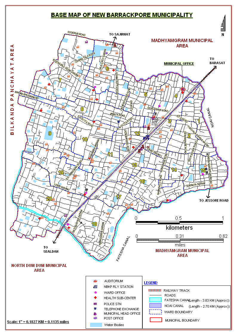
About New Barrackpore Municipality

New Barrackpore Municipality is a small but notable ULB situated in the vicinity of Kolkata. It is at a distance of about 17 km from proper Kolkata. Its area is 6.89sq.km. It has on its western boundary, a canal known as Noai. Its eastern boundary is marked by another canal, namely Fatesha. The north of it is demarcated by Sodepur Road and aforesaid Noai canal. North DumDum Municipality lies on its south. New Barrackpore Municipality is a small but notable ULB situated in the vicinity of Kolkata. It is at a distance of about 17 km from proper Kolkata. Its area is 6.89sq.km. It has on its western boundary, a canal known as Noai. Its eastern boundary is marked by another canal, namely Fatesha. The north of it is demarcated by Sodepur Road and aforesaid Noai canal. North DumDum Municipality lies on its south.Its population as per 2001 census, is 76,879 (including BPL population of 21%).
Geography:
New Barrackpore town is situated near Jessore Road/National Highway 12. The bus stop near New Barrackpore on Jessore Road is B.T. College and many buses pass through here. The only bus (Mini bus) that enters into New Barrackpore is S17. New Barrackpore railway station, which is on the Sealdah-Bangaon line, is 17 km from Sealdah railway station. It is part of the Kolkata Suburban Railway system. The town is located at 22.6924° N, 88.4493° E.